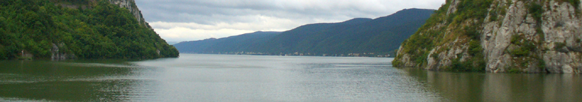
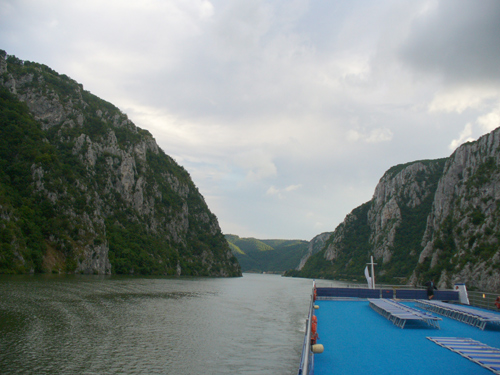
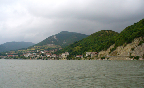
 Most of a day was spent sailing on the Danube, with many scenes such as this.
By 11PM we encountered the locks at the Iron Gate Dam.
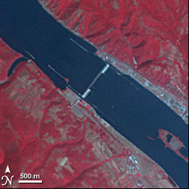
The Iron Gate (Romanian: Portile de Fier) is a gorge on the Danube River. It forms part of the boundary between Serbia on the south and Romania on the north. The Romanian and Hungarian names, Portile de Fier and Vaskapu, literally mean "Iron Gates" and are indeed used to name the entire range of gorges.
From its headwaters in Germany’s Black Forest, the Danube winds its way through ten European countries to drain into the Black Sea. For much of its course, the river moves lazily through wide valleys, but as it enters the border region between Romania and Serbia, its banks narrow into a series of high cliffs. Here, the river carved a passage through the lower Carpathian Mountains to its north and the Balkan Mountains to its south, creating a series of four steep gorges. The Iron Gate gorges created rapids and whirlpools that made navigation difficult. Control over this section of the Danube was gained with the construction of the Iron Gate Dam in the Sip Gorge. . Both of the Danube’s lower gorges and the dam are shown in this image, taken by the Advanced Spaceborne Thermal Emission and Reflection Radiometer (ASTER) on NASA’s Terra satellite
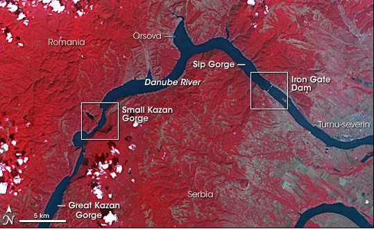
Much of the image is red, where plants and trees cover the land. Tan rocky outcrops snake along mountain tops too high in altitude to support trees and emerge in the steep cliffs that line the river. Signs of human habitation are visible, too; the silver area on the north shore of the river is the Romanian town of Orsova.
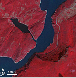 The Danube cuts a wide, blue ribbon through the center of the image above. The river’s narrowest point as it passes through the gorges is at Small Kazan gorge, shown on the image at the right. Within the gorge, the Danube shrinks to 150 meters in width and is flanked by limestone cliffs that reach to about 300 meters. The cliffs are a darker shade of red on the east bank of the river and are accented with dark shadows. After exiting the gorge, the river widens again as it enters the Orsova Valley.
 A “u” bend brings the Danube into the last gorge, the Sip Gorge. Though the land’s wrinkled appearance suggests rugged terrain, the cliffs here are not nearly as severe as in the Kazan gorge.
The dam in Sip Gorge, the white line across the river on the right side of this image, began operation in 1972. As the Danube deepened behind the dam by almost 100 feet, its expanding waters covered at least seven towns, including old Orsova and the island town of Ada Kaleh, a Turkish enclave.
A “u” bend brings the Danube into the last gorge, the Sip Gorge. Though the land’s wrinkled appearance suggests rugged terrain, the cliffs here are not nearly as severe as in the Kazan gorge.
The dam in Sip Gorge, the white line across the river on the right side of this image, began operation in 1972. As the Danube deepened behind the dam by almost 100 feet, its expanding waters covered at least seven towns, including old Orsova and the island town of Ada Kaleh, a Turkish enclave.
Apart from Orsova and a few very small towns, which form tiny silver dots on the north shore of the river, the region is notably free of signs of human habitation west of the Iron Gate Dam. The square grids of vegetation created by agriculture are missing, as are sprawling silver cities. The land on both sides of the river is protected. Djerdap National Park lines the south shore of the river in Serbia, and Portile de Fier National Park forms the Romanian shore in the north. Both parks protect the natural environment as well as significant cultural and historical sites ranging from Neolithic settlements to a medieval fortress.
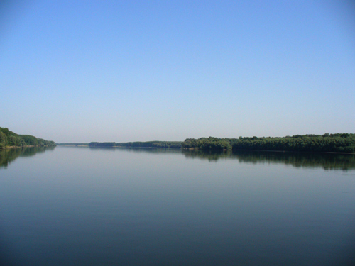
 We went through another lock at 3 AM, and the next morning we could look back at part of the gorge through which we had passed.
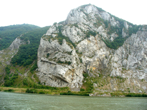 Although these cliffs were not as high as those in the gorges, some were still quite high and a contrast to what we had seen the previous day.
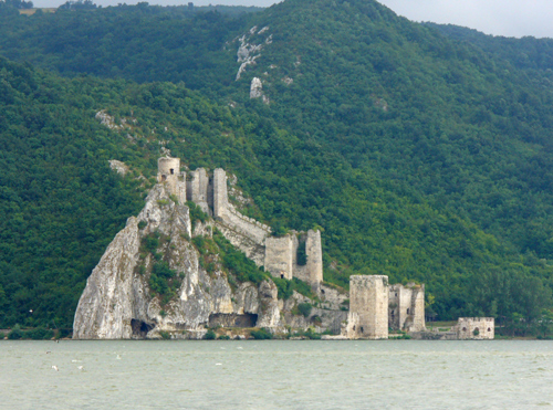 The remains of the Golaubac castle. Constructed at the beginning of the 14th century by Hungarians, the castle of Golubac had been in the hands of Serbs for a short time until it was taken by Turks in 1391. The Austrians had conquered it many times, but the Ottoman controlled this position on the Danube till 1867 when it had been taken by the Serbian State.
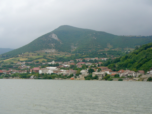
 A village along the Danube.
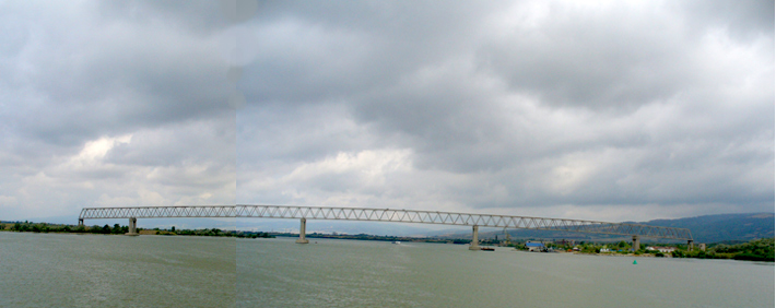 Of interest was this "bridge to nowhere" which was originally designed to link Serbia and Romania, but was never finshed.
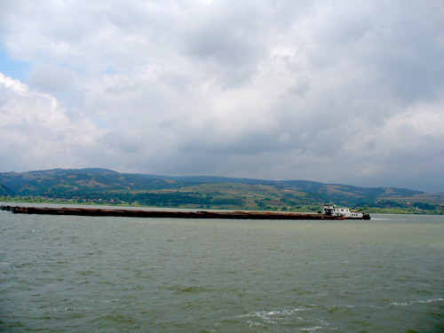 A ship pushing four barges.
After this interesting part of the cruise, we boarded a bus for a two hour ride to Belgrade while the ship sailed there in eight hours.