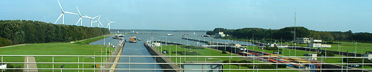
We sailed from Antwerp in late afternoon into the Netherlands by way of the Scheldt-Rhine Canal. There we encountered our first set of locks for this cruise. This first lock was not much of a change in height, but on the Rhine there is a drop of over 900 feet in the water level from Basel to Nijmegen. On the Rhine the average change of level in a lock is about 30 feet except for two larger ones near Strasbourg. There are 10 locks from Koblenz to Trier and the average change in height for a lock on the Mosel is just over 15 feet.
In going downstream, as the ship approaches the lock a gate opens up. The ship enters the lock chamber until the ship is completely inside.

The gate behind the ship closes. Then the lock is drained until it reaches the same water level as the lower side of the chamber.
The second gate opens and the ship exits at the lower level of the lock. In going upstream, the water level is raised while the ship is in the lock and the ship exits at the higher level.
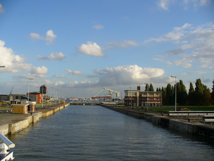
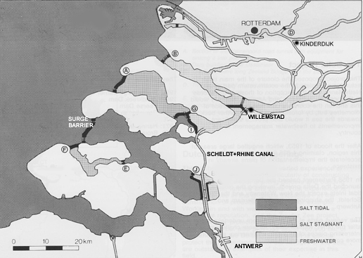
Antwerp is at the bottom of this map and the Scheldt-Rhine Canal proceeds north from there.The ship docked for the night at Willemstad and many of us on the tour went to see the storm surge barrier, which is part of the Delta Works. There are three large inlets which are covered by this project. The one marked B is a dam which keeps out the salt water but has sluices to allow fresh water from the Rhine to escape at times of river flooding. The second one, marked A, is also a dam, but its sluices also allow some salt water in to maintain the salinity of that inlet. The third is a surge barrier which allows normal tides to preserve sea life but has gates which can be lowered to prevent flooding by the ocean.
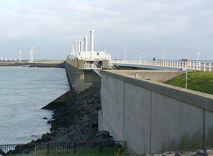
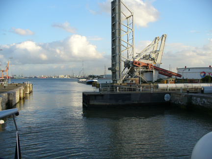
Here we see part of the storm surge barrier. On the right, beyond the railing we see a car on the roadway. The tall cylinders are hydraulic cylinders to lower the gates in the case of a storm or high tide. We enter beneath the roadway just to the right of the wall in the foreground
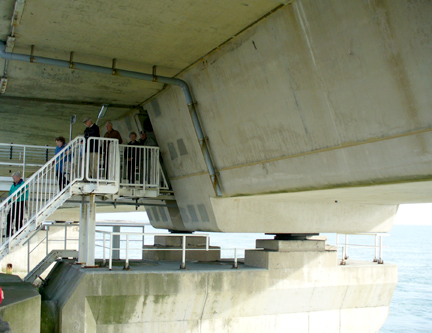 From under the roadway we took stairs down to get a better view of the gates.
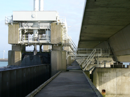
At the left we see a gate and the hydraulic cylinder which would lower it in case of a storm surge.
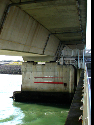
The red markers indicate water levels at which the gates would be closed.
Continue to Kinderdijk.